The Myth of the Untouched Landscape
The untouched landscape is often an illusion. Learn to read hedges, ridges, paths, and woodland edges as clues while separating visible details from possible explanations.
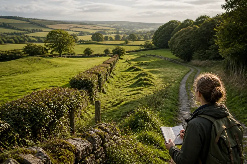
The common mistake in reading a quiet hillside is to assume that, because no buildings or machinery are visible, nobody has shaped it. That can hide old grazing patterns, drainage, quarrying, or field divisions softened by grass. It can also tempt a walker to turn one suggestive hollow into a confident story about the past.
The myth of the untouched landscape is easier to question when you look at how its parts fit together. A bank beneath a hedge, a track that avoids wet ground, or a straight woodland edge may reflect human choices, natural processes, or both. Start with what the terrain presents, then ask what explanations remain plausible.
What does “untouched” mean on a walk?
“Natural” can describe vegetation, landform, a lack of visible construction, or simply a feeling of remoteness. Those meanings do not always line up: a wood can support native plants and still have been cut, grazed, or replanted over time.
Instead of writing “ancient boundary,” record “a low bank with trees growing along it.” The plain description is useful even if later evidence changes your interpretation.
How can a hedge reveal the shape of a field?
Look at the hedge as a line in the landscape, not just as vegetation. Does it divide fields, follow a slope, turn at a junction, or continue as scattered trees? A bank or ditch beside it may help distinguish a boundary from an isolated row of planting.
Its pattern can suggest how land was divided or managed, but it cannot date the boundary by itself. A tree line might be an old enclosure, a later shelter belt, or a planting that replaced an earlier boundary. Field shapes, gates, and map editions add context without necessarily settling the question.
View the line from different points on an established path. What looks continuous from one angle may separate into several planted groups from another.
What can ridges and hollows tell you?
A ridge or hollow takes its meaning from its form and setting. A single uneven mound differs from a repeated pattern; a hollow that channels water downhill has a different relationship to the terrain from one that crosses a slope. Those distinctions help describe what is present, even when the feature’s origin remains unclear.
Imagine you see several low, roughly parallel ridges in a grassy field, with no visible bank or ditch. You note their direction, compare it with the slope, and look from the field edge to see whether the pattern continues. The result is a more precise observation—parallel ridges crossing the field—not a proven account of cultivation or date.
Why can a woodland edge be more revealing than its interior?
Dense growth can hide old field edges, tracks, and changes in ground level. At the edge, you may be able to see a straight boundary, a bank, a ditch, or a track entering the trees. These features can point to past land use, but an old-looking wood is not necessarily ancient woodland.
Tree age and species can raise questions about planting and management, but neither provides a complete history on its own. Compare the visible edge with a current map or an older map edition, and stay on permitted paths rather than disturbing plants or ground features.
What makes a worn track look older than it is?
A hollow track can resemble a long-established route, but repeated recent use, livestock, or water flowing downhill can also wear a line into the ground. Notice what it connects: a bridge, farm entrance, boundary gap, or settlement edge may clarify its practical role without establishing its age.
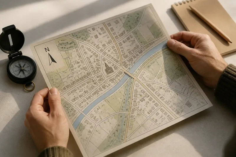
Compare the route with a current map and, if available, an older one. If it appears on both, you can say that it is represented in those map editions; the maps alone do not tell you when it began or how people used it.
Which details should guide your next observation?
Use these checks to make a field note more useful. Each result points to a next action, not a guaranteed explanation.
- Check the feature’s form: if it is a bank, hollow, line, or cluster, describe that shape first; if its form is unclear, sketch its position relative to a path rather than naming it.
- Check its direction: if a line follows a slope or field edge, note that relationship; if it crosses the slope, compare where it begins and ends before proposing a use.
- Check for a ditch or bank beside a hedge: if one is visible, record which side it lies on; if neither is clear, treat the trees as a possible planting as well as a boundary.
- Check whether a ridge repeats: if several similar ridges run in parallel, record their shared direction; if there is only one irregular rise, keep natural and human causes open.
- Check where a track leads: if it reaches a bridge, gate, or settlement edge, note the connection; if it fades into wet ground or vegetation, describe where it ends instead of assigning it a destination.
- Check the map record: if an older map shows the same line, note that it was recorded in that edition; if it does not, compare another source or leave its mapped history unresolved.
- Check for access or conservation guidance: if signs or local rules restrict access, follow them and observe from a permitted route; if the feature is fragile or its status is unclear, do not walk over, clear, or dig into it.
What questions help separate a clue from a claim?
Can a landscape really be untouched?
A place can lack visible recent construction without being free of human influence. Earlier use may have left faint, buried, or overgrown traces that are difficult to recognize.
Does an irregular field boundary mean it is old?
Irregularity alone cannot date a boundary. Describe its course, then compare nearby features and map evidence before suggesting a history.
Can an old map show what a feature was for?
A map can show that a feature was represented in a particular edition, but it may not explain its origin or purpose. Read it alongside the feature’s position and shape on the ground.
What if two explanations still fit?
Keep both possibilities in your notes and identify what evidence might distinguish them, such as a relationship to a stream or a line shown on another map. If no further clue is available, leave the origin open.
When is a cautious description enough?
Stop at description when the ground supports no firmer claim. You can record a bank that may be a boundary, or a path that appears worn, without attaching a specific date or story.
The myth of the untouched landscape does not need a dramatic alternative. On your next walk, choose one hedge, ridge, or woodland edge and write down its shape, direction, and nearest visible connection. That note gives any later map comparison or local-history enquiry a clear place to begin.